Europe's newest climate guardian just opened its eyes
Sentinel-3C's first images are in, and its readings of sea level and Greenland's ice already match the reference data. Better numbers mean coastal cities can plan ahead.
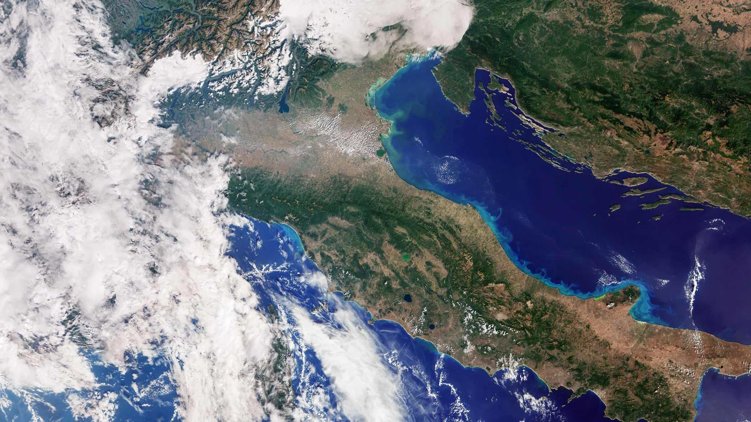
Europe has a new pair of eyes in orbit, and they work. Sentinel-3C, the latest satellite in the EU’s Copernicus Earth-observation programme, has sent back its first images and measurements, and the early results look excellent.
The first pictures were taken on 29 and 30 September, just two weeks after the satellite reached orbit. One of them shows a crisp view of Italy, with the snowy Alps to the north and the Mediterranean wrapped around the peninsula.
The numbers already add up
The pictures are the pretty part. The real job is measurement. Sentinel-3C’s radar altimeter, which measures the height of the sea surface and of ice, is already producing sea-level readings that broadly match data from the Copernicus Marine Service. Its measurements of the Greenland ice sheet, taken between 30 September and 4 October, closely match the reference elevation model.
In plain terms: the satellite is still in testing, but its instruments are delivering reliable data from day one.
Why this is good news
According to the European Space Agency, global sea levels have risen by an average of 3.64 millimetres a year since 1999. Measuring that precisely is what lets governments and coastal towns get ahead of the problem: where to reinforce a beach, how to design a harbour, which neighbourhoods to protect first.
Sentinel-3C will also help track melting ice and other climate signals. If all goes to plan, it will enter full service after about five more months of testing and calibration.